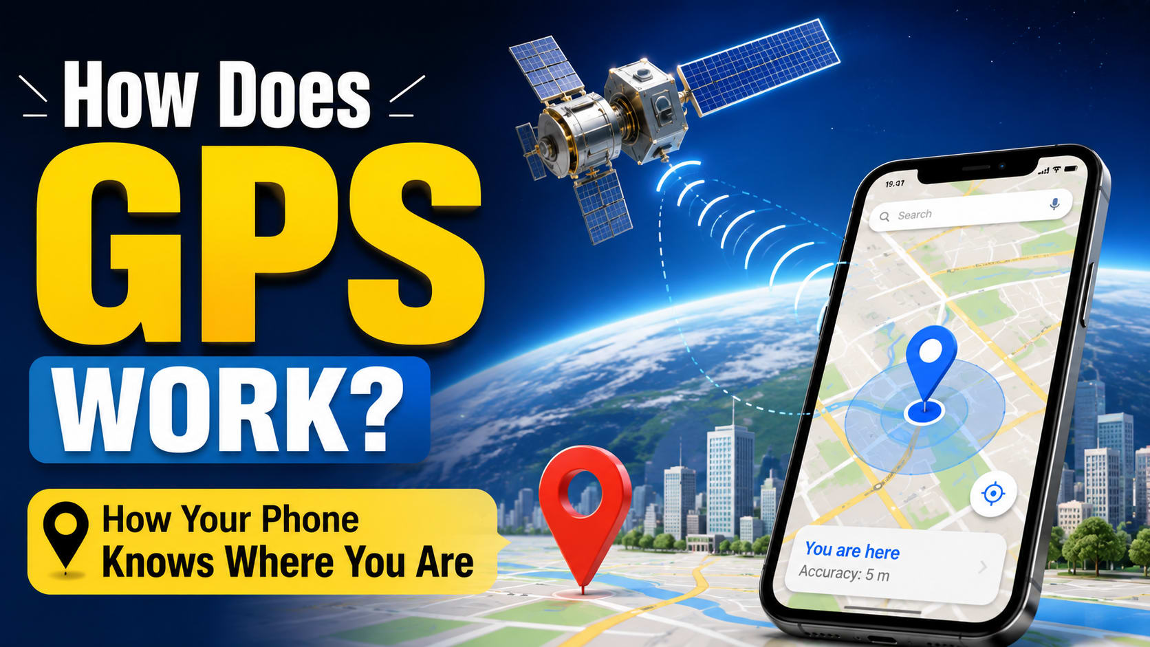
Have you ever opened Google Maps, waited for that little blue dot to appear, and wondered:
"How does my phone know exactly where I am?"
You could be standing in a street you've never visited before. You could be driving through another city. You could even be hiking somewhere with no mobile signal.
Yet your phone can often look at a map and tell you where you are.
Pretty crazy, right?
The interesting part is that your phone doesn't have to ask someone, "Where am I?"
Instead, it can calculate its position by listening to signals coming from satellites orbiting thousands of kilometers above Earth.
And it does this incredibly quickly.
So, how does GPS work?
The basic idea is surprisingly simple:
Your phone receives signals from multiple GPS satellites, measures how long those signals took to arrive, and uses that information to calculate its position.
Of course, the real technology is much more complicated.
There are satellites, atomic clocks, radio signals, mathematical calculations, atmospheric corrections, orbital data, and several other technologies working together.
Let's break the whole thing down in a way that actually makes sense.
What Is GPS?
GPS stands for Global Positioning System.
It is a satellite-based positioning, navigation, and timing system operated by the United States. The system has three major parts:
Space segment — satellites orbiting Earth
Control segment — ground stations that monitor and maintain the system
User segment — GPS receivers in phones, cars, watches, navigation devices, and other equipment
GPS provides positioning information by transmitting signals from satellites to receivers on Earth.
Your phone contains a tiny GPS receiver.
It doesn't need to transmit a signal to the GPS satellites just to determine its location.
Instead, the satellites continuously broadcast signals, and your phone listens to them.
That's an important point.
GPS satellites don't track your phone
A common misunderstanding is:
"The GPS satellite is following my phone."
Not really.
GPS satellites are essentially broadcasting reference signals. Your receiver listens to those signals and calculates its own position. GPS.gov describes the satellites as one-way beacons rather than devices that track phones on the ground.
So the basic relationship is:
GPS Satellite
      ↓
  Radio Signal
      ↓
Your Phone
      ↓
Calculate Position
The satellite doesn't need to know where you are.
Your phone figures it out.
How Does GPS Work?
Let's start with the simplest possible example.
Imagine you're lost somewhere and there are three friends standing at known locations.
You call them and ask:
"How far away are you from me?"
Friend A says:
"You're 5 km away from me."
Friend B says:
"You're 8 km away from me."
Friend C says:
"You're 3 km away from me."
Now you can use those distances to narrow down where you must be.
GPS uses a similar idea.
Instead of friends, you have satellites.
Instead of asking them how far away you are, your phone calculates the distance based on the travel time of their radio signals.
And instead of drawing simple circles on a flat map, GPS solves the problem in three dimensions.
This technique is called trilateration.
What Is GPS Trilateration?
The word trilateration sounds complicated, but the concept is actually pretty easy.
Trilateration means determining your position based on your distance from known points.
Those known points are GPS satellites.
Imagine this:
                 Satellite A
                     ●
                  /     \
                 /       \
                /         \
               /     📱    \
              /             \
             ●---------------●
        Satellite B       Satellite C
Your phone knows where the satellites are.
It also estimates how far away each satellite is.
When those distances are combined, your possible location becomes much more constrained.
With more satellite measurements, the receiver can calculate a much better position.
GPS.gov explains the basic positioning concept using the relationship:
Distance = Rate × Time
The rate is approximately the speed of light, because GPS signals are radio signals traveling through space, and the receiver uses the signal's travel time to estimate distance.
Why Does GPS Need More Than One Satellite?
One satellite isn't enough to tell your phone exactly where it is.
Imagine a satellite tells your phone:
"You are approximately 20,000 km away from me."
That doesn't identify one specific point.
You could be anywhere on a huge surface around that satellite.
Now add another satellite.
The possible locations become much smaller.
Add another.
The possibilities narrow even further.
And then GPS receivers generally use a fourth satellite measurement to solve for the receiver's clock error along with its three-dimensional position. GPS.gov's educational material describes four satellites as the point at which a receiver can determine its position in three dimensions and account for receiver time.
So, a simplified view is:
Satellites | What happens |
|---|---|
1 | Huge number of possible locations |
2 | Possibilities become more limited |
3 | Position can be narrowed significantly |
4 | Helps solve position + receiver clock offset |
More | Can improve robustness and accuracy |
Your phone can often see more than four satellites, which is useful because extra measurements can help the receiver find a better solution.
The Secret Ingredient: Extremely Accurate Time
Here's where GPS gets really interesting.
Remember that GPS calculates distance using:
Distance = Speed × Time
The speed is approximately the speed of light.
That means even a tiny error in measuring time can create a significant error in distance.
For example, radio signals travel incredibly fast.
So if your phone gets the timing wrong by even a tiny amount, its calculated distance to a satellite can be wrong.
That's why GPS needs extremely accurate clocks.
And this is where atomic clocks come in.
GPS Satellites Have Atomic Clocks
GPS satellites carry highly precise atomic clocks.
These clocks provide extremely accurate timing information that is included in the signals transmitted by the satellites.
Why is this important?
Imagine a satellite sends a signal at:
12:00:00.000000
Your phone receives it slightly later.
The difference between the transmitted time and the received time tells the receiver approximately how long the signal traveled.
Then:
Distance = Speed × Travel Time
The phone can use that to estimate its distance from the satellite.
And when it does this with several satellites, it can calculate its position.
Why Doesn't My Phone Have an Atomic Clock?
You might be thinking:
"Wait. If GPS needs incredibly accurate time, does my phone contain an atomic clock?"
No.
That would be a little impractical.
Your phone has a normal electronic clock.
Instead, the GPS receiver uses the signals from multiple satellites to estimate and correct its own clock error.
This is actually one of the reasons the fourth satellite measurement is so important.
Your phone is solving for several unknowns at once:
Your position in the X direction
Your position in the Y direction
Your position in the Z direction
Your receiver clock offset
So the GPS receiver is doing some serious mathematics in the background.
What Information Does a GPS Satellite Send?
A GPS satellite doesn't simply send:
"Hello, I'm Satellite #12."
Its signal contains information that helps the receiver determine how to interpret the signal.
Among other things, GPS signals provide information related to:
Satellite position
Satellite time
Satellite status
Navigation data
Clock information
The receiver uses this information together with the signal's arrival time to calculate ranges and ultimately position.
So the communication looks roughly like this:
GPS Satellite
      ↓
Satellite position
Satellite time
Navigation information
      ↓
Radio signal
      ↓
Your phone
      ↓
Measure arrival time
      ↓
Calculate distance
      ↓
Calculate position
How Far Away Are GPS Satellites?
GPS satellites operate in Medium Earth Orbit.
They orbit at roughly 20,200 km above Earth's surface.
That's incredibly far away.
For comparison, imagine standing outside and looking at your phone.
Your GPS receiver is picking up extremely weak radio signals that have traveled roughly tens of thousands of kilometers from satellites overhead.
And somehow your phone can use those signals to calculate where you are.
That's one of the reasons GPS is such an impressive piece of engineering.
GPS Satellites Are Always Moving
Another important thing to understand is that GPS satellites aren't sitting still above one location.
They orbit Earth.
A GPS satellite circles Earth roughly twice per day. The GPS constellation is arranged across multiple orbital planes to provide worldwide coverage.
So your phone needs to know where those satellites are right now.
It can't simply assume:
"Satellite A is always here."
The satellite's position changes constantly.
That's why GPS navigation data contains information that helps receivers determine the satellites' positions.
What Happens When You Open Google Maps?
Let's make this practical.
Imagine you open Google Maps.
You see a map.
Then, after a moment, a blue dot appears.
What happened?
A simplified version looks like this:
Step 1: Your phone activates its location hardware
Your phone starts gathering location information from available sources.
Step 2: It listens for GPS signals
The GPS receiver searches for signals from satellites that are visible from your location.
Step 3: It identifies satellite signals
The receiver determines which satellites it can use.
Step 4: It measures signal timing
Your phone compares the timing information in the received signals with its own measurements.
Step 5: It estimates distances
Using the signal travel time and the speed of light, the receiver estimates its distance from the satellites.
Step 6: It calculates its position
The receiver uses multiple satellite measurements and mathematical algorithms to solve for its position and clock offset.
Step 7: Your operating system uses the result
The phone's location system can then provide coordinates to apps such as maps and navigation applications.
Step 8: The map displays your location
Finally:
That little blue dot appears.
All of this can happen surprisingly quickly.
Your Phone Doesn't Only Use GPS
Here's something many people don't realize.
When you see your location on a smartphone, the phone may not be relying on GPS alone.
Modern smartphones can combine information from multiple technologies.
For example:
Technology | What it can provide |
|---|---|
GPS/GNSS | Satellite-based positioning |
Wi-Fi | Nearby network/location information |
Cellular networks | Approximate location from cell infrastructure |
Bluetooth | Nearby device/beacon information |
Motion sensors | Movement and orientation information |
Maps/database data | Roads, buildings, addresses, and places |
This combination can make location services faster and more useful.
For example, when you're inside a building, satellite signals can become weak or blocked.
Your phone can potentially use other sources of information to help estimate your location.
So when someone says:
"My phone knows where I am because of GPS."
That's often a useful simplification, but modern smartphone location systems can involve more than GPS alone.
GPS vs GNSS: Are They the Same Thing?
You may also see the term GNSS.
GNSS stands for Global Navigation Satellite System.
GPS is one GNSS.
Other satellite navigation systems include:
GPS — United States
Galileo — European Union
GLONASS — Russia
BeiDou — China
Modern phones can often use signals from multiple satellite navigation systems.
This gives the receiver more satellites to work with and can improve availability and positioning performance.
So technically:
GPS ≠ all satellite navigation.
GPS is one system within the larger GNSS family.
Why Does GPS Sometimes Take Time to Find You?
Sometimes you open a map and your location appears almost immediately.
Other times you see:
"Searching for GPS..."
Why?
Your phone needs to acquire and process usable satellite signals.
Several things can make this harder.
You're indoors
Buildings can block or weaken satellite signals.
You're surrounded by tall buildings
This can create a difficult environment for satellite reception.
You haven't used location services recently
The receiver may need more time to obtain useful satellite information.
You're under heavy cover
Dense trees, structures, or other obstacles can affect signal reception.
Your device has poor visibility of satellites
The geometry and number of usable satellites matter.
So GPS doesn't work equally well everywhere.
Why Does GPS Work Better Outside?
GPS signals have traveled a very long distance before reaching your phone.
By the time they arrive, they're extremely weak.
That's why having a clear view of the sky can help.
Outside, your phone may be able to receive signals from many satellites across different parts of the sky.
Inside a building, however, the roof and walls can significantly weaken or block the signals.
That's why your phone might show:
High accuracy
outside but struggle inside a large building.
Why Is GPS Sometimes Wrong?
You might have experienced this while using navigation.
The blue dot suddenly appears:
On the wrong side of the road
Inside a building
On a nearby street
A few meters away from your actual location
GPS isn't perfect.
The accuracy of a GPS position depends on factors such as:
Satellite geometry
Signal blockage
Atmospheric conditions
Receiver design
Signal reflections
Local environment
GPS.gov notes that smartphone GPS accuracy under open sky is typically around a few meters, with the exact performance depending on conditions and device design.
What Are GPS Signal Reflections?
Here's another interesting problem.
Imagine you're standing next to a huge glass building.
A GPS signal can sometimes reach your phone through a direct path.
But it can also bounce off buildings and other surfaces before reaching the receiver.
So the receiver may effectively receive:
Satellite
    ↓
    ↓ Direct signal
    ↓
  Phone


Satellite
    ↓
 Building
    ↘
     ↘ Reflected signal
       ↓
     Phone
Now the phone has to deal with signals that didn't all travel along the same path.
This can introduce errors.
This phenomenon is commonly called multipath.
It is one reason GPS performance can be worse in dense cities than in an open field.
What Happens to GPS Signals in the Atmosphere?
GPS signals travel from satellites through Earth's atmosphere before reaching your phone.
The atmosphere can affect the signals' travel time.
GPS receivers use models and correction techniques to account for some of these effects.
The result is much better positioning than simply assuming every signal traveled through a perfect vacuum.
This is another example of why real GPS is more complicated than the simple:
Distance = Speed × Time
formula we use to understand the basic concept.
Why Does GPS Need Ground Stations?
You might think:
"If the satellites are in space, why does GPS need anything on Earth?"
Because the satellites need to be monitored and maintained.
GPS has a control segment consisting of ground infrastructure that monitors the satellites, tracks their orbits, manages their health, and uploads updated navigation information.
Think of it like this:
              GPS Satellites
             ↙      ↓      ↘
            ↙       ↓       ↘
     Ground Monitoring Stations
                 ↓
        Control & Updates
                 ↓
          Satellite System
                 ↓
             Your Phone
The ground system helps make sure the satellite constellation continues to provide accurate and reliable information.
GPS Is Also a Giant Clock
Here's something that surprises many people.
GPS isn't only useful for finding your location.
It is also an extremely important timing system.
GPS satellites carry atomic clocks and transmit precise timing information.
That timing can be used by systems on Earth for synchronization. GPS timing is used in areas such as telecommunications, electrical power systems, and financial networks.
So GPS is really providing something broader than:
"Where am I?"
It provides:
Where am I?
And what time is it?
That makes GPS much more important to modern infrastructure than most people realize.
Does GPS Need Mobile Data?
Not necessarily.
This is another common misconception.
The GPS receiver itself can calculate a position from satellite signals without needing mobile internet.
However, navigation apps often need internet access for other things, such as:
Downloading map data
Searching for places
Getting live traffic
Finding businesses
Receiving route updates
Downloading map tiles
So you can have:
GPS Positioning
        +
Offline Maps
        =
Offline Navigation
provided the relevant map and navigation data are already stored on your device.
This is why offline maps can still show your position even when you don't have a mobile data connection.
GPS vs Internet Location
Let's make the difference really clear.
GPS
Uses satellite signals to calculate your position.
Satellite
    ↓
Radio Signal
    ↓
Phone
    ↓
Position
Internet-based location
Can use network information such as Wi-Fi or cellular infrastructure.
Wi-Fi / Cellular
       ↓
    Phone
       ↓
 Approximate Location
Modern smartphones can combine multiple sources rather than relying on just one.
Why Does GPS Work Almost Anywhere?
One of GPS's biggest advantages is its global coverage.
The satellite constellation is designed so that users around the world can receive signals from multiple satellites.
The baseline GPS constellation uses six orbital planes and is designed around a 24-slot arrangement that provides worldwide availability; the United States maintains additional operational satellites beyond that baseline.
That's why GPS isn't limited to one city or country.
You can use it:
In India
In the United States
In Europe
In Australia
At sea
In remote areas
In many places without mobile coverage
As long as your receiver can obtain usable satellite signals, it can potentially determine a position.
How GPS Helps Navigation
Knowing your location is only half the story.
A navigation app also needs to know:
Where do you want to go?
Suppose you're driving from one city to another.
Your phone can repeatedly determine your position.
Then the navigation app compares that position with map data.
It can calculate things such as:
Current road
Direction of travel
Distance to destination
Estimated arrival time
Route options
Turns
Traffic conditions
So navigation is really a combination of several technologies.
GPS/GNSS
   ↓
Your Location
   ↓
Map Data
   ↓
Routing Algorithm
   ↓
Navigation Instructions
   ↓
"Turn Left in 200 meters"
GPS tells the phone where you are.
The navigation software figures out what you should do next.
A Simple Example: Finding John
Let's imagine John is standing somewhere in a city.
His phone receives signals from four GPS satellites.
The phone estimates:
Satellite A → Distance ≈ 21,000 km
Satellite B → Distance ≈ 23,000 km
Satellite C → Distance ≈ 20,500 km
Satellite D → Distance ≈ 22,000 km
The receiver also knows the satellites' positions.
Now it uses mathematics to find the location that best fits all those measurements.
The result might be something like:
Latitude: 23.xxxx
Longitude: 87.xxxx
Altitude: xxx m
The operating system then turns those coordinates into something useful for apps.
Instead of showing John a bunch of numbers, the map displays:
"You are here."
That's the magic of GPS.
The Complete GPS Process
Let's put the entire process together.
        ┌───────────────────────┐
        │     GPS Satellites    │
        │                       │
        │ Precise Time          │
        │ Satellite Position    │
        │ Navigation Data       │
        └───────────┬───────────┘
                    │
                    │ Radio Signals
                    ↓
             ┌──────────────┐
             │ Your Phone   │
             │ GPS Receiver │
             └──────┬───────┘
                    │
                    ↓
          Measure Signal Timing
                    │
                    ↓
          Estimate Satellite
               Distances
                    │
                    ↓
             Trilateration
                    │
                    ↓
          Solve Position +
            Clock Offset
                    │
                    ↓
          Latitude / Longitude
               / Altitude
                    │
                    ↓
             Map Application
                    │
                    ↓
              📍 You Are Here
This is a simplified diagram, but it captures the main idea.
GPS in Your Everyday Life
You probably use GPS more often than you realize.
🚗 Driving
Navigation apps use your location to guide you.
🚶 Walking
Your phone can track your walking route.
🏃 Fitness
Running and cycling apps can record your route and distance.
✈ Aviation
GPS and other navigation systems support aircraft navigation.
🚢 Shipping
Ships can use satellite positioning for navigation.
📦 Logistics
Companies can track vehicles and optimize routes.
🚜 Agriculture
Precision agriculture can use satellite positioning for accurate field operations.
⌚ Smartwatches
Outdoor watches can use satellite positioning to record activities.
📸 Photography
Location information can be attached to photos.
So GPS isn't just something that makes Google Maps work.
It's part of a much larger positioning ecosystem.
Advantages of GPS
GPS became incredibly important because it provides several major benefits.
Advantage | Why It Matters |
|---|---|
Global coverage | Works across most of the world |
No subscription for basic civilian service | Basic civilian GPS service is freely available |
Doesn't require mobile towers | Satellite signals come directly to the receiver |
High accuracy | Often accurate to a few meters under good conditions |
Works day and night | Satellites continuously transmit signals |
Supports navigation | Enables maps and route guidance |
Provides precise time | Useful for communication and infrastructure |
GPS.gov states that the civilian GPS service is freely available worldwide on a continuous basis.
Limitations of GPS
GPS also has limitations.
It can struggle when:
You're deep inside a building
You're surrounded by tall buildings
Signals are blocked
Signals are reflected
Satellite visibility is poor
Atmospheric effects introduce errors
The receiver hardware isn't very capable
So if your GPS suddenly thinks you're standing 20 meters away from where you actually are, that doesn't mean the entire GPS system is broken.
The receiver is working with real-world signals that can be affected by the environment.
So, How Does GPS Work in One Sentence?
If someone asks you "How does GPS work?", you can now give them a pretty good answer:
GPS works by having satellites broadcast precisely timed radio signals containing information about their position; a receiver measures when those signals arrive, estimates its distance from multiple satellites, and uses trilateration and precise timing to calculate its own position.
That's the core idea.
But underneath that simple explanation are incredibly precise clocks, orbital calculations, radio engineering, atmospheric corrections, ground monitoring stations, and sophisticated algorithms.
Final Takeaway
The next time you open a map and see that little blue dot, remember what is actually happening.
Thousands of kilometers above Earth, GPS satellites are continuously broadcasting radio signals.
Your phone listens.
It figures out which satellites it can use.
It measures the timing of their signals.
It calculates how far away they are.
It combines measurements from multiple satellites.
It corrects for timing and signal-related errors.
Then it calculates your position.
And finally, your map turns a bunch of coordinates into something you actually understand:
📍 You are here.
The really amazing part?
Your phone doesn't need to ask the satellite:
"Where am I?"
The satellite only provides the reference information.
Your phone does the mathematics and figures it out itself.
Frequently Asked Questions
1. Does GPS work without the internet?
Yes. A GPS receiver can calculate its position from satellite signals without an internet connection. However, navigation apps may still need internet access for maps, traffic, searches, and other online features.
2. Does GPS work without a SIM card?
Yes. GPS itself does not require a SIM card.
3. Does GPS work indoors?
It can sometimes work near windows or in locations where signals can penetrate, but GPS generally performs better outdoors with a clearer view of the sky.
4. How many satellites does GPS need?
A receiver generally needs measurements from at least four satellites to solve for three-dimensional position and receiver clock offset. In practice, it can use more satellites when available.
5. Do GPS satellites track my phone?
No. GPS satellites broadcast one-way signals. Your receiver uses those signals to calculate its own location.
6. Why is GPS sometimes inaccurate?
Signal blockage, reflections, atmospheric effects, satellite geometry, and receiver quality can all affect accuracy.
7. Does GPS use radio waves?
Yes. GPS satellites transmit radio signals that GPS receivers use for positioning.
8. What is the difference between GPS and GNSS?
GPS is the U.S. Global Positioning System. GNSS is the broader term for global satellite navigation systems, which includes GPS as well as systems such as Galileo, GLONASS, and BeiDou.
9. Why does GPS need atomic clocks?
GPS relies on extremely precise timing because the receiver estimates distance from the travel time of radio signals. Tiny timing errors can translate into significant positioning errors.
10. Can GPS tell my exact location?
GPS provides an estimate of your position, not an infinitely precise point. Under good conditions, smartphone GPS can often achieve accuracy within several meters, but real-world accuracy varies.
Recommended Reading
If you're learning how computers and devices communicate, GPS is a great example of how radio communication, networking, mathematics, and hardware come together.
You can continue with our Computer Networks Tutorial to understand other technologies that allow devices to communicate.
For authoritative information about GPS, its satellites, accuracy, and how the system works, check the official GPS.gov website.
Internal link: Replace YOUR-INTERNAL-COMPUTER-NETWORKS-URL with the actual URL of your Computer Networks tutorial/category.
External link: Use the official GPS.gov link for the authoritative reference.